Are you looking for a trekking adventure in the Himalayas that is also spiritual? If so, Amarnath and Kedarnath are your top two choices. Both are high-altitude Shiva pilgrimage sites — but they are very different in terms of difficulty, season, terrain, and who they suit best.
This guide compares both treks honestly across every factor that matters — distance, altitude, terrain, best time, accessibility, and helicopter options — so you can make the right decision for your situation.
Quick verdict: Amarnath is harder. It is longer, higher, more remote, and its season (July–August) coincides with monsoon, which adds rain and mud to an already demanding route. Kedarnath is serious but more accessible and has a significantly better-developed support infrastructure.

Amarnath vs Kedarnath — Quick Comparison Table
| Factor | Amarnath | Kedarnath | Winner |
|---|---|---|---|
| Altitude | 3,888 metres (12,756 ft) | 3,583 metres (11,755 ft) | Kedarnath — lower, safer |
| Trek Distance | 46 km from Pahalgam / 14 km from Baltal | 16 km from Gaurikund | Kedarnath — shorter |
| Trek Duration | 3–5 days (Pahalgam) / 1–2 days (Baltal) | 5–8 hours one way | Kedarnath — single day |
| Season | July–August only | May–June, September–October | Kedarnath — dry season |
| Terrain | Rocky, steep, snow patches, narrow trails | Stone-stepped, steep but wider | Kedarnath — wider, better maintained |
| Weather During Trek | Monsoon — rain, mud, occasional snow | Dry season — more predictable | Kedarnath — more reliable |
| Infrastructure | Basic, limited facilities | Better developed — medical posts, tea stalls | Kedarnath — better support |
| Helicopter Available | Yes — from Baltal and Pahalgam | Yes — from Phata, Sirsi, Guptkashi | Kedarnath — closer to temple |
| Difficulty Level | High | Moderate-High | Kedarnath — more accessible |
| Best For | Physically fit, experienced trekkers | First-timers, families, moderate fitness | Depends on pilgrim |
About Amarnath
The Amarnath Cave sits at 3,888 metres in Jammu and Kashmir — one of the highest pilgrimage sites in India. The cave is best known for its naturally forming ice Shivling, a stalagmite of ice that grows and shrinks with the lunar cycle. It is believed to represent Lord Shiva himself.
The Yatra is open only during July and August — the Hindu month of Shravan — which means the entire pilgrimage happens during the monsoon season. Rain, fog, muddy trails, and occasional snowfall are standard conditions, not exceptions.
Two base routes exist:
- Pahalgam route: 46 km one way — longer, more gradual ascent, takes 3–5 days
- Baltal route: 14 km one way — shorter, but very steep, can be done in 1 day
The Pahalgam route is considered more manageable for first-timers despite its length. The Baltal route is physically intense — steep throughout with no gradual acclimatisation.
About Kedarnath
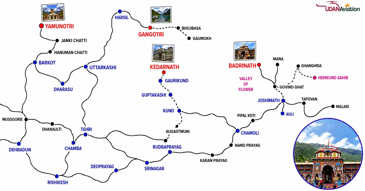
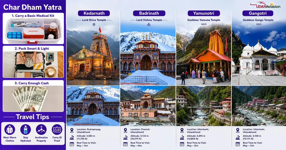
Kedarnath Temple sits at 3,583 metres in the Rudraprayag district of Uttarakhand — one of the 12 Jyotirlingas and a key stop in the Char Dham Yatra. The temple is believed to have been built by the Pandavas and restored by Adi Shankaracharya in the 8th century CE.
The trek from Gaurikund is 16 km one way — a single-day journey for most pilgrims, taking 5–8 hours ascending. The season runs May–June and September–October — dry months with far more predictable weather than Amarnath’s monsoon window.
The 2013 floods destroyed everything around the temple while the structure itself remained standing. Since then, significant infrastructure improvements — medical aid posts, wider stone paths, better drainage — have made the trek safer than before 2013.
Kedarnath opened on 2nd May 2026. It closes on 11th November 2026.
Factor-by-Factor Comparison
Trek Distance and Duration
Kedarnath is 16 km from Gaurikund — one day, 5–8 hours. Most pilgrims complete it in a single day.
Amarnath via Pahalgam is 46 km — a 3 to 5 day journey involving multiple overnight camps at Sheshnag and Panchtarni. Via Baltal, it is 14 km but extremely steep — most pilgrims complete it in one very demanding day.
Winner for accessibility: Kedarnath — significantly shorter and completable in a single day.
Altitude and Oxygen Levels
Amarnath Cave: 3,888 metres — oxygen approximately 38% lower than at sea level.
Kedarnath Temple: 3,583 metres — oxygen approximately 35% lower than at sea level.
The 305-metre difference is meaningful. At Amarnath, AMS (Altitude Mountain Sickness) risk is slightly higher. The Baltal route compounds this — a very rapid ascent from 2,743 metres to 3,888 metres in 14 km with minimal acclimatisation time.
Winner for altitude safety: Kedarnath — lower altitude with more gradual ascent from base.
Terrain and Trail Conditions
Kedarnath trail from Gaurikund: Stone-stepped path, well-maintained, wider track, medical posts every 3–4 km. First 4 km are the steepest; the middle section opens into valley.
Amarnath trail from Pahalgam: Rocky, uneven, includes glacier crossings and muddy sections — particularly at Mahagunas Pass (4,150 metres), which is the highest point on the route. From Baltal, the trail is narrower and significantly steeper throughout.
Winner for trail conditions: Kedarnath — better maintained, wider path, more facilities.
Season and Weather Conditions
Kedarnath season: May–June and September–October — dry months, relatively predictable weather. Morning starts are key as afternoon clouds build, but rain is not a constant.
Amarnath season: July–August only — peak monsoon in the Himalayas. Rain is almost guaranteed during the trek. Trail sections become muddy and slippery. Occasional snowfall even in August at higher elevations. Fog can reduce visibility significantly.
Winner for weather reliability: Kedarnath — dry season treks are dramatically more comfortable.
Infrastructure and Facilities
Kedarnath: Medical aid posts every 3–4 km, well-stocked tea stalls, rest points, pony and palki services with official booking counters, GMVN guesthouses.
Amarnath: Langar (free food) provided by seva organisations, basic tents and camps, medical facilities — but significantly fewer permanent facilities than Kedarnath given the seasonal-only nature of the route.
Winner for pilgrims wanting support: Kedarnath.
Best Time to Visit
| Destination | Best Season | Months | Temperature Range |
|---|---|---|---|
| Kedarnath | Spring | May–June | 5°C–15°C (day) / 0°C–5°C (night) |
| Kedarnath | Autumn | September–October | 3°C–12°C (day) / -2°C–4°C (night) |
| Amarnath | Monsoon window | July–August | 8°C–15°C (day) / 2°C–8°C (night) — with rain |
Amarnath has no flexibility on season — the Yatra runs only in July–August. Kedarnath pilgrims can choose between spring (May–June) and autumn (September–October) based on preference.
Which Is Easier to Reach?
Kedarnath is easier to reach. Gaurikund is accessible by road from Haridwar via a well-maintained (if winding) mountain highway. The entire route is within Uttarakhand with no permit requirements for Indian citizens.
Amarnath requires reaching Srinagar or Jammu first, then base camp at Pahalgam or Baltal. An Amarnath Yatra Permit is mandatory — issued by the Shri Amarnathji Shrine Board (SASB). No permit means no entry. Permits are available online at jksasb.nic.in or through nationalised banks.
Which Is Suitable for Senior Citizens?
Kedarnath is more suitable for senior citizens — shorter trek (16 km), better infrastructure, pony and palki service at official prices, and helicopter option from three helipads (Phata, Sirsi, Guptkashi).
Amarnath is less suitable for elderly pilgrims — longer route, monsoon weather, more demanding terrain. The Baltal helicopter option makes it more accessible, but the Baltal ground trek itself is very steep.
For seniors above 65: the Kedarnath helicopter is the recommended choice. Medical fitness check before booking is essential for either destination.
Helicopter Yatra — Available for Both
Kedarnath Helicopter
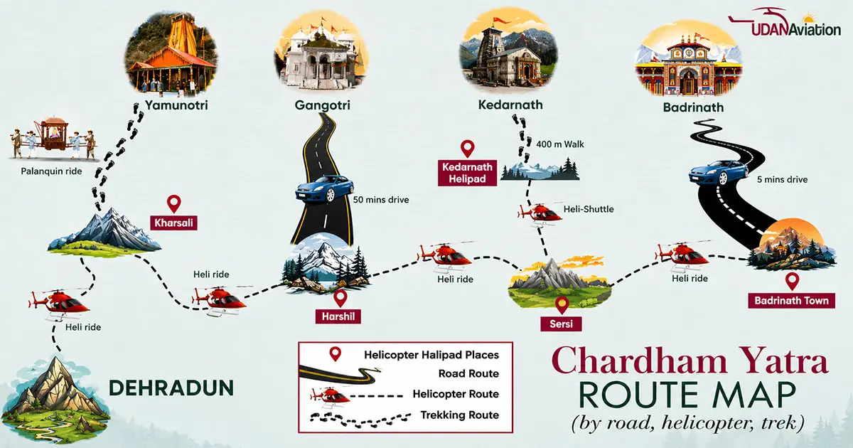
Helicopters operate from three helipads: Phata, Sirsi, and Guptkashi. Flight time: 8–12 minutes to the Kedarnath helipad, approximately 1–1.5 km from the temple. Operating window: 6:00 AM–10:00 AM only — wind speeds increase significantly after 11 AM.
Book through the IRCTC official portal (heliyatra.irctc.co.in) or through verified operators like Udan Aviation.
Amarnath Helicopter
Helicopters operate from Neelgrath (Baltal side) to Panchtarni, then a 6 km trek to the cave. From Pahalgam side, helicopters operate from Pahalgam helipad to Panchtarni. Flight time: approximately 8–10 minutes. Pilgrims still need to walk the final 6 km from Panchtarni to the cave.
Key difference: Kedarnath helicopter gets you 1–1.5 km from the temple. Amarnath helicopter still requires a 6 km trek from Panchtarni to the cave — at 3,800+ metres altitude.
Safety Tips
For Kedarnath
- Consult doctor before booking if above 60 or with heart/BP/respiratory conditions
- Start the Gaurikund trek by 5–6 AM — avoid afternoon weather
- AMS symptoms: headache, nausea, dizziness — stop ascending immediately
- Carry personal medicines with 3-day extra supply
- Pulse oximeter recommended (₹800–₹1,200)
- Register at registrationandtouristcare.uk.gov.in — compulsory
For Amarnath
- Obtain Amarnath Yatra Permit from jksasb.nic.in before travel — no permit, no entry
- Online registration also available at yatra.cdac.in — the official Amarnath Yatra registration portal
- 2026 Amarnath Yatra registration opens typically in April — check jksasb.nic.in for exact dates
- Rain gear is mandatory — trail conditions during July–August are genuinely wet
- Do not attempt Baltal route without good physical fitness — it is steep throughout
- Acclimatise at Pahalgam or Baltal overnight before starting the trek
- Check weather and security advisories before each day of travel
FAQs
Q1. Which is more difficult — Amarnath or Kedarnath?
Amarnath is harder — longer route (46 km from Pahalgam), monsoon season, higher altitude (3,888m), and more demanding terrain than Kedarnath’s 16 km stone-stepped trail.
Q2. Which is higher — Amarnath or Kedarnath?
Amarnath — at 3,888 metres vs Kedarnath at 3,583 metres. A difference of 305 metres.
Q3. Which is better for first-time pilgrims?
Kedarnath — shorter trek, dry season, better infrastructure, and helicopter option from three helipads.
Q4. Do I need a permit for Amarnath Yatra 2026?
Yes — mandatory. Register at yatra.cdac.in (official portal) or jksasb.nic.in. Also available through designated nationalised banks. Registration typically opens in April each year.
Q5. Is Kedarnath registration compulsory?
Yes — register free at registrationandtouristcare.uk.gov.in. Each pilgrim registers individually.
Q6. Can senior citizens do Amarnath Yatra?
With caution. The Baltal helicopter reduces ground trekking to 6 km, but at 3,800+ metres with monsoon conditions. Kedarnath helicopter is the lower-risk option for elderly pilgrims.
Q7. What is the distance between Amarnath and Kedarnath?
Approximately 800 km by road between the two pilgrimage sites.
Q8. Which gives a more adventurous experience?
Amarnath — the Pahalgam route across glaciers and high mountain passes is a genuine multi-day Himalayan expedition. Kedarnath is deeply spiritual but more accessible.
Conclusion
Amarnath is the harder trek — longer, higher, in monsoon season, with more demanding terrain. Kedarnath is serious but manageable for fit pilgrims in a single day, with helicopter options and better infrastructure throughout.
Both are profoundly meaningful pilgrimages. The choice depends on your fitness, available time, and which season works for your schedule.
If you are considering either Yatra by helicopter, Udan Aviation operates services for both Kedarnath and Amarnath. Contact us to plan the right option for your group.
📞 +91-93104-19931 | ✉ info@udanaviation.in | 🌐 www.udanaviation.in